


8 km | 11.2 km-effort
![Trail On foot Česká Třebová - [Ž] Serpentýny - Hory - Photo](https://media.geolcdn.com/t/1900/400/bd44ac32-e646-4cc9-8783-18dc2e4b84e1.jpeg&format=pjpeg&maxdim=2)

Tous les sentiers balisés d’Europe GUIDE+


FREE GPS app for hiking
 SityTrail
IGN / Geographical institutes
SityTrail World
The world is yours!
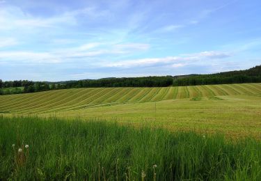
Trail On foot of 5.2 km to be discovered at Northeast, Pardubický kraj, Česká Třebová. This trail is proposed by SityTrail - itinéraires balisés pédestres.
Trail created by cz:KČT.
![Trail On foot Česká Třebová - [Ž] Serpentýny - Hory - Photo 1](https://media.geolcdn.com/t/2048/auto/2bae37e8-f510-4ffc-b15b-c83976754ac8.jpeg&format=jpg&maxdim=0 "Trail On foot Česká Třebová - [Ž] Serpentýny - Hory - Photo 1")
![Trail On foot Česká Třebová - [Ž] Serpentýny - Hory - Photo 2](https://media.geolcdn.com/t/2048/auto/39b422bd-85c4-4c8c-9f74-618c69b85e85.jpeg&format=jpg&maxdim=0 "Trail On foot Česká Třebová - [Ž] Serpentýny - Hory - Photo 2")
![Trail On foot Česká Třebová - [Ž] Serpentýny - Hory - Photo 3](https://media.geolcdn.com/t/2048/auto/6ed24d58-c3e5-4275-bf87-3f5920afd99b.jpeg&format=jpg&maxdim=0 "Trail On foot Česká Třebová - [Ž] Serpentýny - Hory - Photo 3")
![Trail On foot Česká Třebová - [Ž] Serpentýny - Hory - Photo 4](https://media.geolcdn.com/t/2048/auto/10364c7a-dd2b-4924-80c9-fb255bbabe25.jpeg&format=jpg&maxdim=0 "Trail On foot Česká Třebová - [Ž] Serpentýny - Hory - Photo 4")
![Trail On foot Česká Třebová - [Ž] Serpentýny - Hory - Photo 5](https://media.geolcdn.com/t/2048/auto/e701d46f-b104-431f-8aa1-55aa34d73a10.jpeg&format=jpg&maxdim=0 "Trail On foot Česká Třebová - [Ž] Serpentýny - Hory - Photo 5")
![Trail On foot Česká Třebová - [Ž] Serpentýny - Hory - Photo 6](https://media.geolcdn.com/t/2048/auto/edfbe2b1-7cc3-49c4-a5c0-e9fc3954acf3.jpeg&format=jpg&maxdim=0 "Trail On foot Česká Třebová - [Ž] Serpentýny - Hory - Photo 6")
![Trail On foot Česká Třebová - [Ž] Serpentýny - Hory - Photo 7](https://media.geolcdn.com/t/2048/auto/ed45fb04-8263-4b1f-8a69-7c38b285dd02.jpeg&format=jpg&maxdim=0 "Trail On foot Česká Třebová - [Ž] Serpentýny - Hory - Photo 7")
![Trail On foot Česká Třebová - [Ž] Serpentýny - Hory - Photo 8](https://media.geolcdn.com/t/2048/auto/88a437fe-8685-4424-b14b-2eaf14f30aae.jpeg&format=jpg&maxdim=0 "Trail On foot Česká Třebová - [Ž] Serpentýny - Hory - Photo 8")
![Trail On foot Česká Třebová - [Ž] Serpentýny - Hory - Photo 9](https://media.geolcdn.com/t/2048/auto/6d35d4e3-6b9a-4dca-9580-75c5f9f56d11.jpeg&format=jpg&maxdim=0 "Trail On foot Česká Třebová - [Ž] Serpentýny - Hory - Photo 9")
![Trail On foot Česká Třebová - [Ž] Serpentýny - Hory - Photo 10](https://media.geolcdn.com/t/2048/auto/bd44ac32-e646-4cc9-8783-18dc2e4b84e1.jpeg&format=jpg&maxdim=0 "Trail On foot Česká Třebová - [Ž] Serpentýny - Hory - Photo 10")
On foot
![Trail On foot Přívrat - [Ž] Zhořský kopec - Pod Lysinou - Photo](https://media.geolcdn.com/t/375/260/1e28bd45-3668-454f-9395-9932e6e89961.jpeg&format=jpg&maxdim=2)
On foot
On foot